


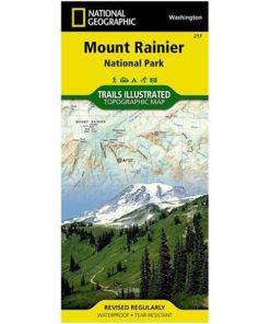


The highest point in the Cascade Range, Mount Ranier is an icon of Washington state. It is an active volcano and the largest single-peak glacial system in the lower forty-eight states, spawning 6 major rivers. National Geographic’s Trails Illustrated map of Mount Ranier National Park is designed to meet the needs of outdoor enthusiasts by combining valuable information with unmatched detail of this spectacular landscape of glaciers, old-growth forests, subalpine meadows, and valleys. Created in partnership with local land management agencies, this expertly researched map features key areas of interest including Paradise, Longmire, White River, Mowich Lake, Ohanapecosh, Chinook Scenic Byway, Crystal Mountain, and Glacier View Wilderness.
Only logged in customers who have purchased this product may leave a review.
Related products


Western Mountaineering
Western Mountaineering-bag-ultralite 6ft 0in 20 degree bag-ULTRALITE_6_0


PATAGONIA


CASCADE DESIGNS


THE NORTH FACE


HYDRO FLASK


HYDRO FLASK
what our customer say this product:
There are no reviews yet